Weather Intelligence for Drone Operations
The most robust weather prediction platform for UAS operators, powered by real-time sensors, high-resolution models, and aviation-specific data.
Beyond Standard Weather Forecasts
TruWeather V360 combines traditional weather models with our proprietary analytics and exclusive sensor network for industry-leading reliability that other apps simply can't match.
Advanced Sensor Network
Access to 50,000+ traditional and novel sensors providing hyperlocal weather conditions with sub-hourly updates.
Real-Time Data Fusion
Our algorithms seamlessly integrate sensor data with gridded datasets to generate a dynamic, real-time picture of the weather.
FAA Weather Intelligence
Trusted METAR, TAF, PIREP, SIGMET, and AIRMET data integrated into an intuitive interface for weather risk assessment.
Purpose-Built for Drone Operations
Every feature in TruWeather V360 is designed specifically to support UAS operators in the field.
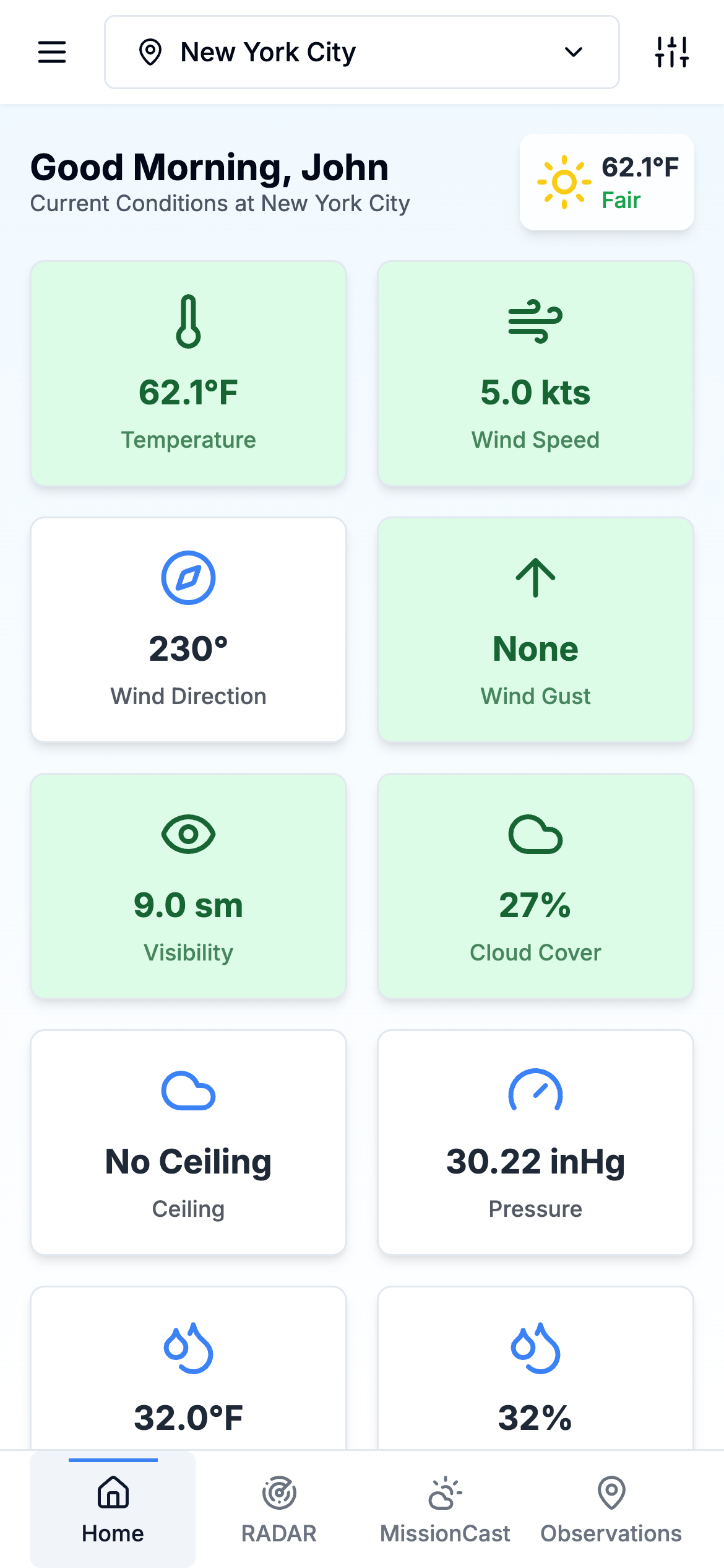
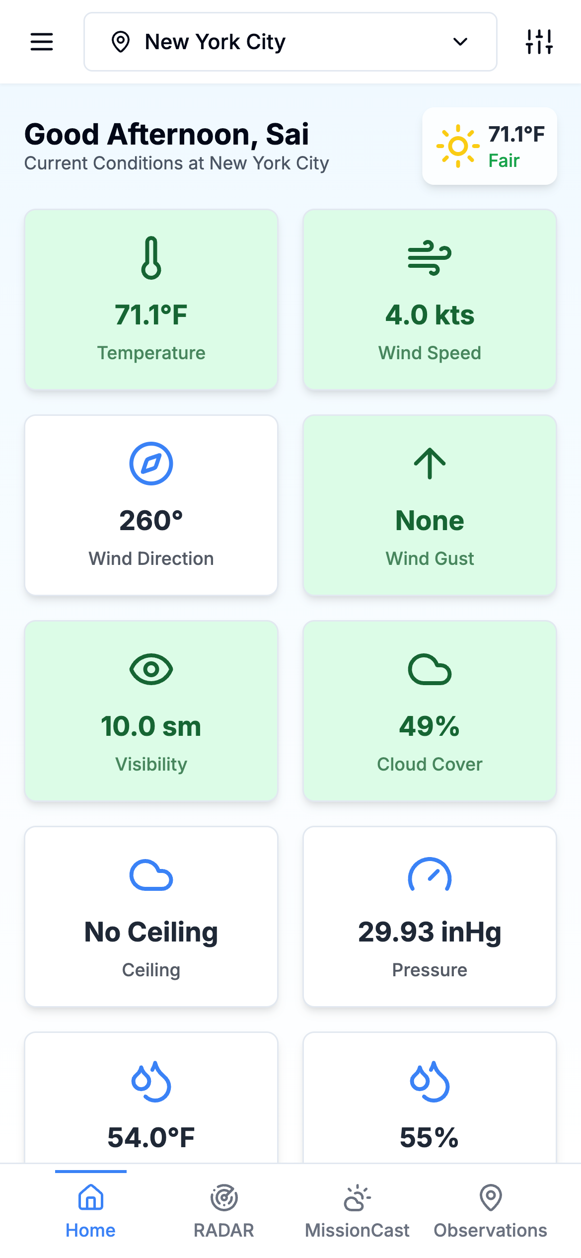
Current Conditions at a Glance
Get instant access to critical weather parameters with visual indicators and customizable parameter cards showing all the metrics that matter for your flight operations.
- Color-coded risk assessment
Instantly understand if conditions are favorable for flight with our intuitive color system
- Customizable parameters
Configure your dashboard to show the weather metrics most important to your specific operations
- Hyperlocal conditions
See weather conditions specific to your exact location, not just the nearest airport or city
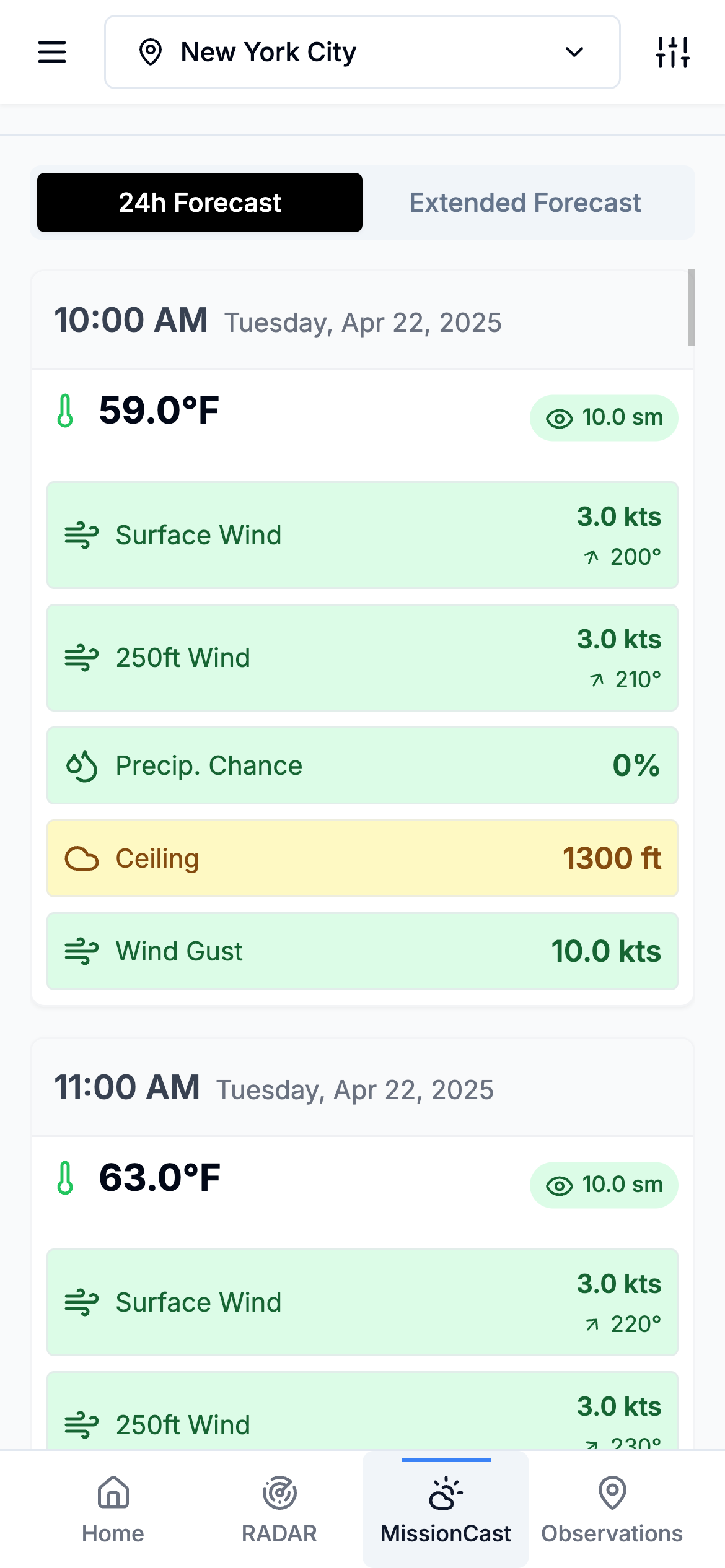
Precision Forecasting for Mission Planning
Plan your flights with confidence and ease using hour-by-hour forecasting with customizable parameters and color-coded safety thresholds.
- 144-hour extended forecasts
Plan missions up to 6 days in advance with detailed hourly predictions
- Flight window identification
Easily identify optimal time periods for safe and efficient drone operations
- Risk assessment indicators
User-defined weather thresholds and visual cues to quickly assess operational risk
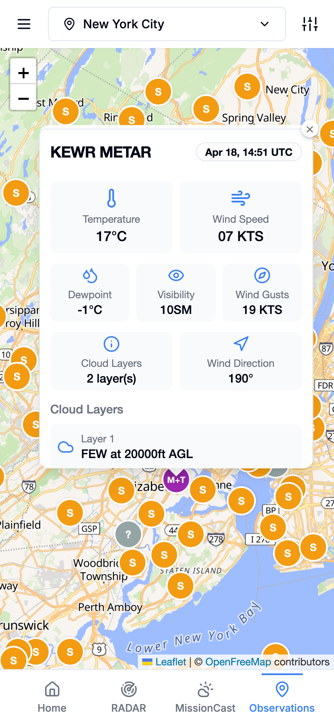
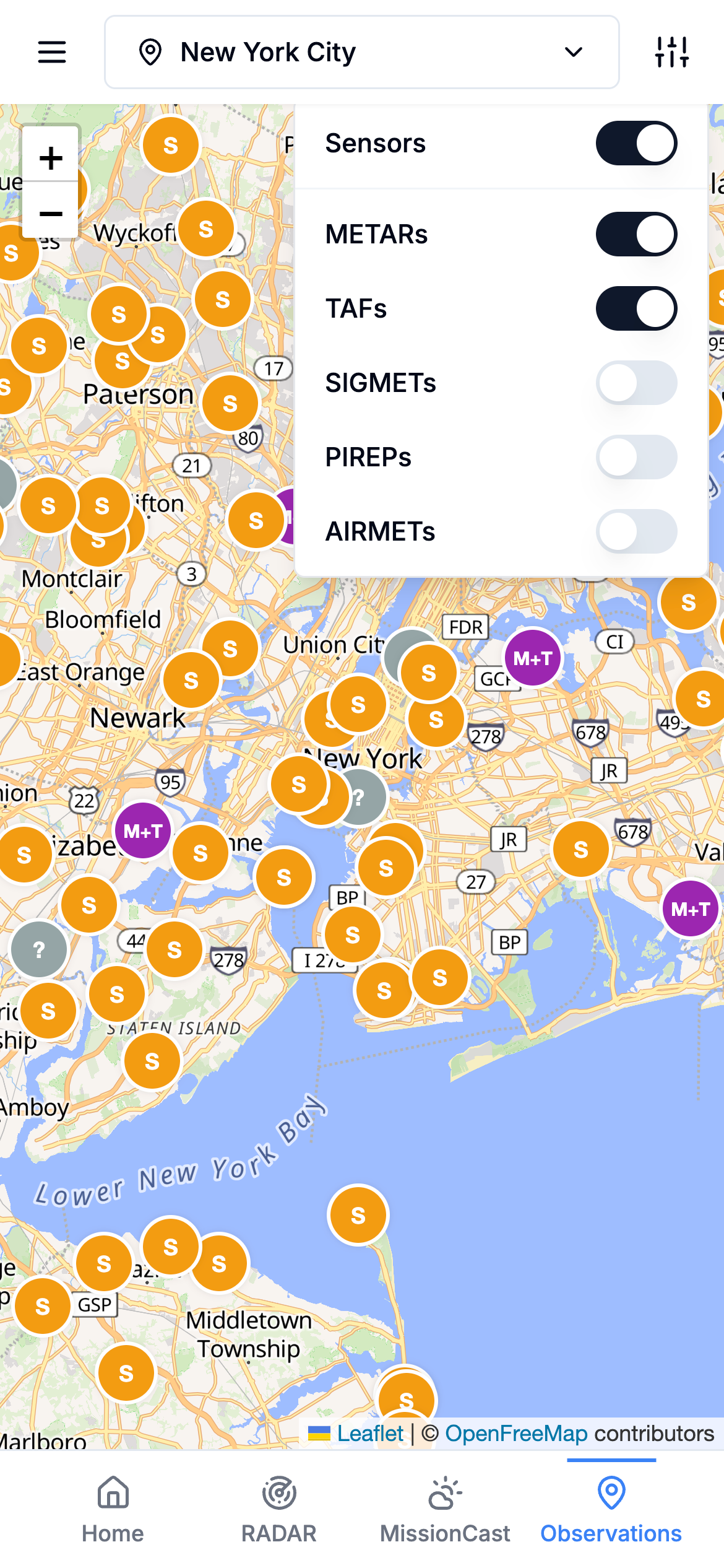
Sensors + FAA Weather Data
Access our exclusive network of 50,000+ sensors combined with aviation weather reports in one intuitive interface.
- Proprietary sensor integration
Exclusive access to our network of ground-based and advanced weather sensors
- Aviation weather reports
Authoritative METAR, TAF, PIREP, SIGMET, and AIRMET data - all in one place.
- Interactive observation map
Visualize sensor locations and data with our interactive mapping interface
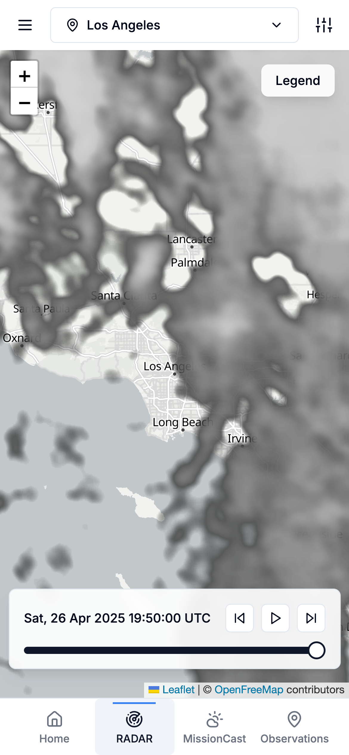
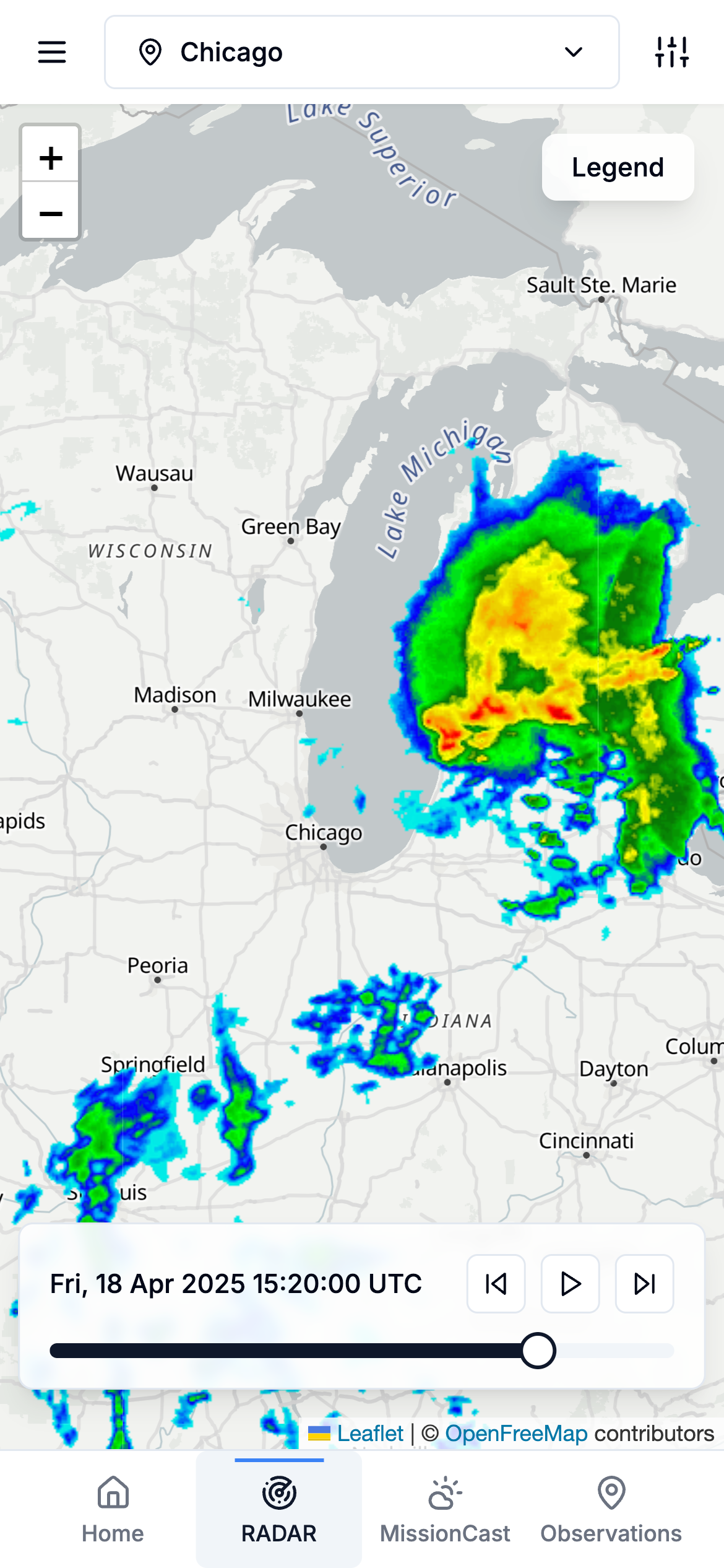
Visualize Weather Patterns
Track precipitation, storms, and cloud cover with our interactive radar and satellite imagery.
- Global coverage
Access high-resolution radar data across 30+ countries worldwide
- Future radar
See predicted precipitation patterns up to 30 minutes in advance
- Multiple layers
Toggle between radar, satellite, and other data layers for comprehensive analysis
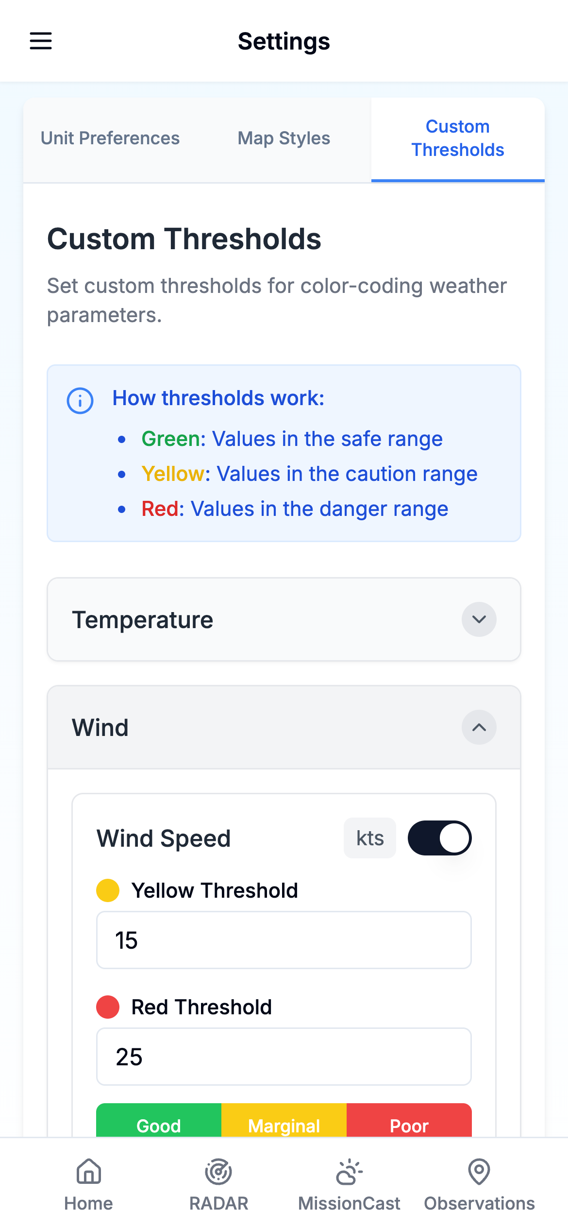
Weather Intelligence in Your Pocket
Take TruWeather V360's powerful forecasting capabilities with you wherever your drone operations take you.
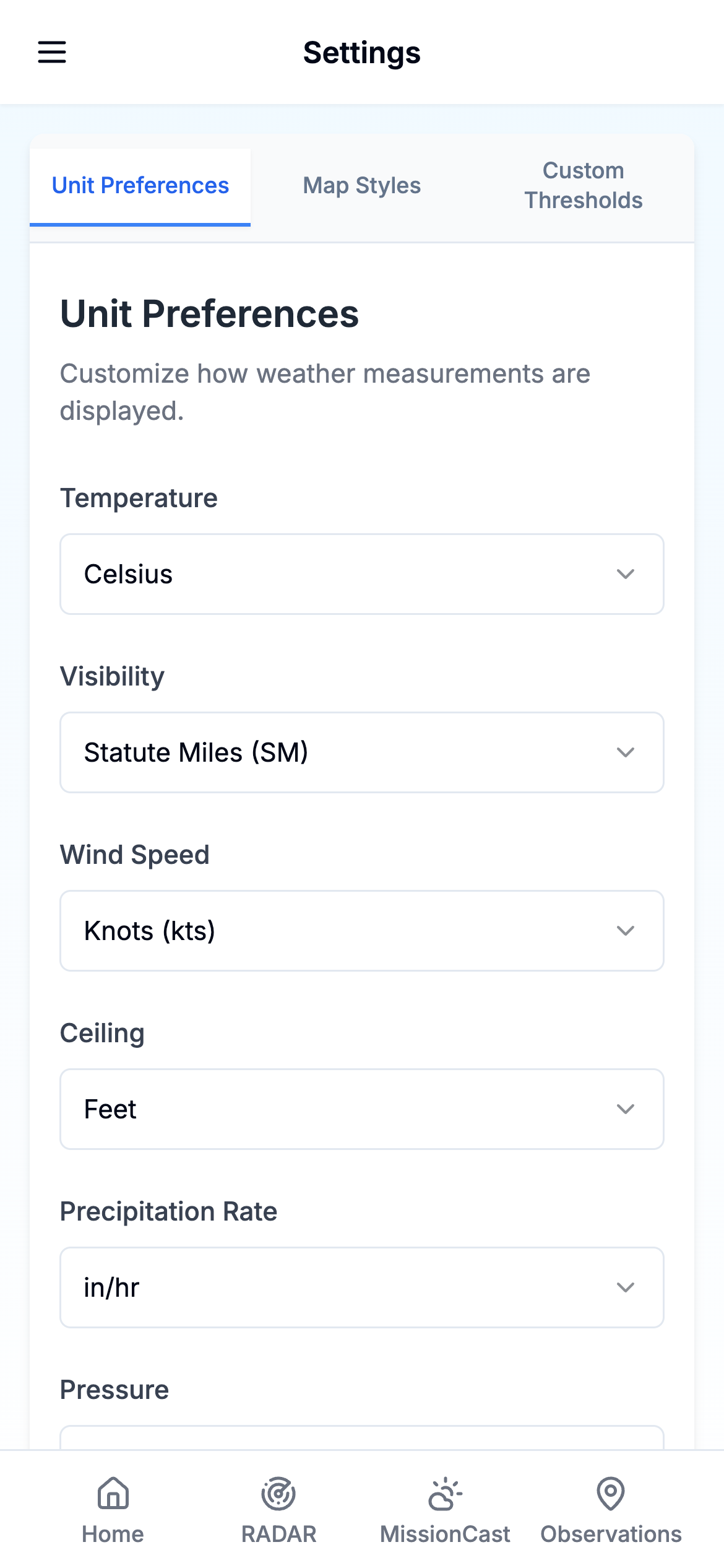
- Custom Units & Thresholds
Set your preferred measurement units and define custom thresholds for flight safety parameters
- Location Awareness Coming Soon
Automatically receive weather data for your current location or save multiple operation sites
- Push Notifications Coming Soon
Get alerts when weather conditions change or when forecasts indicate optimal flight windows
Getting started is a breeze
Join our exclusive waitlist to experience TruWeather V360 before the public launch and help shape the future of drone weather intelligence.
Be Among the First
Join our exclusive waitlist to experience TruWeather V360 before the public launch and help shape the future of drone weather intelligence.
Join the Waitlist
Be the first to know when TruWeather V360 launches.